AtlasUnfold
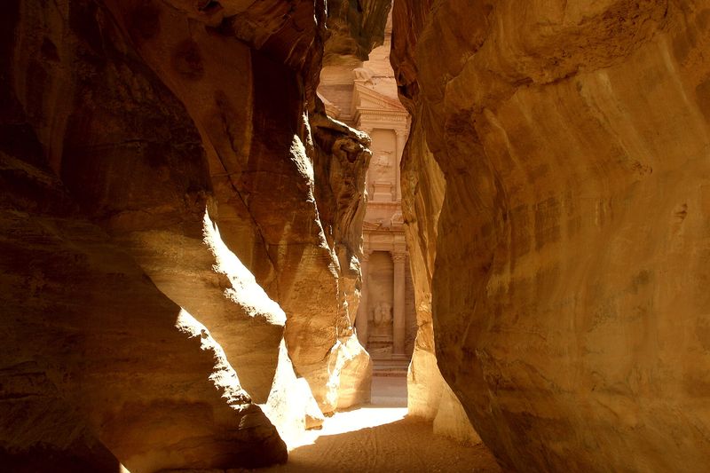
The narrow Siq gorge leading into Petra: dark red walls and a bright opening at the end of the passage
Jordan · UNESCO World Heritage Site

Petra: the city carved into the rock

Enter through the Siq gorge, see the Treasury and climb to the Monastery — six stops with facts, photos and sources.

  • 6 stops
  • From the Siq to the Monastery
  • East to north-west

Photo & credit · Vyacheslav Argenberg · CC BY 4.0

Where we have arrived

Fact file

A short briefing before we enter the gorge. The data come from the UNESCO World Heritage Centre description and published research (see “Sources”).

Country and region
Jordan, Ma’an Governorate, next to the town of Wadi Musa
Civilisation
The Nabataeans, a trading people of Arabia; Petra was their capital
Period
The Nabataean period — from the 4th century BCE to the 1st century CE (UNESCO’s estimate). The founding date of the city is still debated: according to National Geographic it was probably the mid-2nd century BCE.
Status
UNESCO World Heritage Site since 1985, no. 326; criteria (i), (iii), (iv)
Material
Red sandstone. The city is “half built, half carved into the rock”
Role
A caravan hub in the trade in frankincense, silk and spices
Centre of the site
30°19′50″ N, 35°26′36″ E (UNESCO data)
1985year of inscription on the UNESCO list
≈ 6 km²area of the historic centre (National Geographic)
26,171 haprotected area — about 262 km²
The meaning of the place

Why Petra is unique

This is not the “city of the dead” that Petra is often called, but a living trading city whose tombs are only its most visible part.

Millions of people have seen the famous facades, but their fame hides the main thing: Petra was made possible by water and roads. Caravans needed stopping places, stopping places needed water, and in this arid land only those who knew how to collect it had enough.

F established fact · V scholarly view. This is how we mark statements throughout the page.

Cultures blended in stone

Hellenistic facades are combined here with the Eastern tradition of cutting temple-tombs into the rock. UNESCO calls this a “meeting of East and West” at the turn of the eras: Al-Khazneh, the Urn Tomb, the Palace Tomb, the Corinthian Tomb and Ad Deir are examples of this fusion. F

Water in the desert

Channels, tunnels, diversion dams, cisterns and reservoirs made it possible to settle an arid region in the Nabataean, Roman and Byzantine periods. The same system protected the city from winter flash floods. F

A whole city, not only tombs

Excavations have revealed a colonnaded street, a theatre, a nymphaeum fountain, baths, temples and even a garden with a pool. This is a capital with a public life of its own, not a funerary complex. F

An entrance made by nature

The main route from the east is the natural cleft of the Siq. The road into the city is turned into a stage: a narrow shadow, then suddenly open space in front of a facade. F

A city nobody “lost”

The popular story of a “lost city” is inaccurate: Johann Ludwig Burckhardt reached Petra on 22 August 1812, travelling incognito, but, as Aramco World notes, Petra was “never lost” — local people knew it. F

Where we are walking

Map of the expedition

Six stops on a diagram built from OpenStreetMap and Wikipedia coordinates (accuracy about 50 m — positions are approximate). Choose a stop on the diagram or in the list, or move the slider.

  • stop
  • selected
  • order of the visit — not a trail
  • N↑ north is up, the Siq entrance is on the right
How to read the diagram

This is a diagram without a base map: the line between points is straight and only shows the order of the visit, not a real trail — the actual path through the gorges and up the stairs is longer. Relief and elevations are not shown because they were not verified. Point positions are approximate (about 50 m). For a detailed map: Petra on OpenStreetMap.

© OpenStreetMap contributors, ODbL

    The main video journey

    Petra on screen: the NOVA documentary

    The video plays in the official YouTube player after you click. Channel: NOVA PBS Official. The film is in English. Open on YouTube. Cover image: photo by Vyacheslav Argenberg, CC BY 4.0 (Commons). The page reads in full without the video.

    What the film is about

    A feature-length NOVA (PBS) documentary about Petra and the people who study it. In our spot check we saw excavations, the gorge and English narration. We did not watch the whole film, so we do not retell its contents.

    What to look out for

    • how the entrance to the city works — the Siq (stop 1);
    • how archaeologists work — compare it with the discoveries of 2016 and 2024;
    • which questions remain open — dating, the purpose of buildings.

    What to explore in more detail

    To stop 1 — the Siq →

    The route

    Six stops

    We walk the way a traveller walks: from the mouth of the gorge to the centre of the city and on to the Monastery. Distances are straight lines between approximate coordinates; the real path is longer.

    Stop 1 of 6 · start of the route

    The Siq — an entrance made by nature

    The road to Petra begins not with a square but with a crack in the rock.
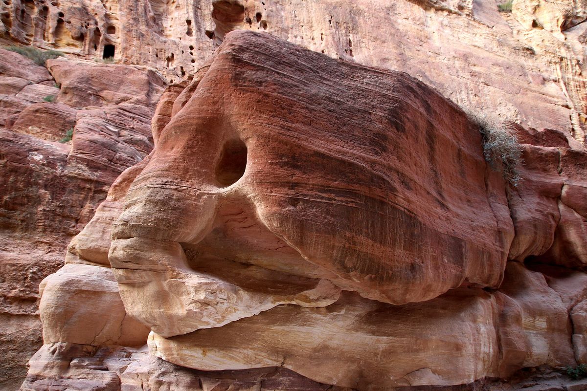
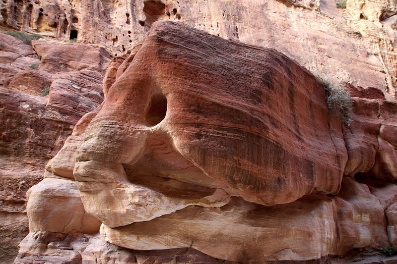
    Walls of the Siq gorge in red-pink sandstone, with a curious rock shape resembling an animal’s head
    The walls of the Siq; a shape resembling an animal’s head can be made out in the rock. Photo & credit · Gerd Eichmann · CC BY-SA 4.0

    What we are looking at

    The Siq is a natural cleft and the main route into the city from the east. It was here that the Nabataeans built a water-diversion system. F To walk the gorge is to retrace the path of the caravans.

    What to notice

    • how the passage narrows into shadow and then opens out again;
    • how the light changes on the sandstone;
    • the last bend, where Al-Khazneh appears in the gap. The rock shape in the photo is a trick of nature, not a discovered monument.

    Historical depth

    The Siq was both a door and a danger: in winter, water from the surrounding hills runs down into it. According to Cultech’s estimate, the hills above the Siq collect about a million cubic metres from a 55 km² catchment. A previously blocked tunnel has been reopened, and the flood threat has decreased. UNESCO warns that without maintenance of the Nabataean diversion system the danger remains. F

    A curious fact

    In the early 1960s, French tourists were killed in the Siq by a sudden flash flood (Cultech). A protection system that had worked for millennia had been forgotten, with tragic results. F

    Video view

    Shows the gorge “Walking the Siq to the Treasury”, Prowalk Tours channel. The frames we checked (at 300 s and 1000 s) show the Siq. YouTube
    Stop 2 of 6 · ≈ 0.45 km from the Siq

    Al-Khazneh — “the Treasury”

    The narrow shadow ends and a courtyard opens, with a facade almost 39 metres high.

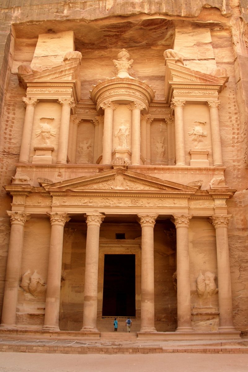
    Vertical view of the facade of Al-Khazneh with people at its foot for scale
    People at the foot show the scale. Photo & credit · Vyacheslav Argenberg · CC BY 4.0
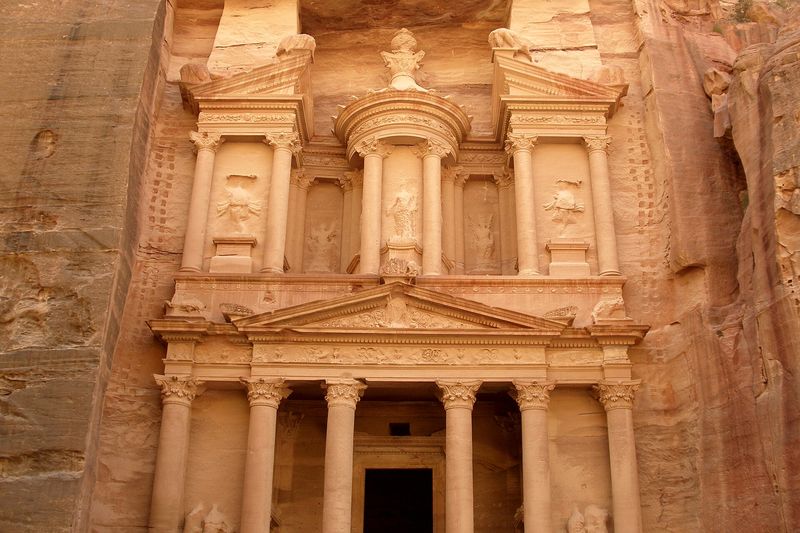
    Close-up of the decoration of Al-Khazneh: columns, a pediment and sculpted figures
    The facade decoration up close. Photo & credit · Vyacheslav Argenberg · CC BY 4.0

    What we are looking at

    A facade 38.8 m high and 24.9 m wide. F The composition, with a broken pediment and a central round pavilion (tholos), is Hellenistic and linked to Alexandria. F It is a Nabataean tomb, probably royal — possibly of Aretas IV. V

    What to notice

    • the abrupt change from the narrow Siq to the spacious courtyard;
    • the figures: Amazons and Victories, probably Isis-Tyche in the centre, and the Dioscuri Castor and Pollux below; F
    • the urn at the top, which gave the facade its Arabic name.

    Historical depth

    The date is disputed: the tombs of Petra have yielded almost no finds that would give an exact year. Specialists believe they were built between the 2nd century BCE and the early 2nd century CE. V

    A curious fact

    The Arabic name Khaznat al-Faraun (“the Pharaoh’s treasury”) grew out of a legend of gold hidden in the urn; the bullet marks on the urn come from Bedouin shots, fired in the hope that the gold would pour out. F And in 2024, ground-penetrating radar helped find a hidden tomb with 12 skeletons beneath the Treasury — a rarity for Petra. F

    Video view

    Walk along the route This video shows the road, not a look at the facade. The frames we checked show the end of the Siq (700 s) and the theatre area (1100 s); the facade of Al-Khazneh itself was not spotted in the frames we viewed. YouTube

    Stop 3 of 6 · ≈ 0.65 km from Al-Khazneh

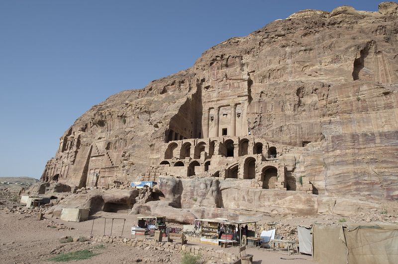
    The Royal Tombs and the Urn Tomb

    The valley opens out, and a row of monumental facades lines the slope.

    Facade of the Urn Tomb with arched supporting galleries and traders’ stalls on the terrace in front of it
    The Urn Tomb; on the terrace are traders’ stalls, the modern life of the place. Photo & credit · Dosseman · CC BY-SA 4.0
    A semicircular theatre cut into the rock, with rows of seats
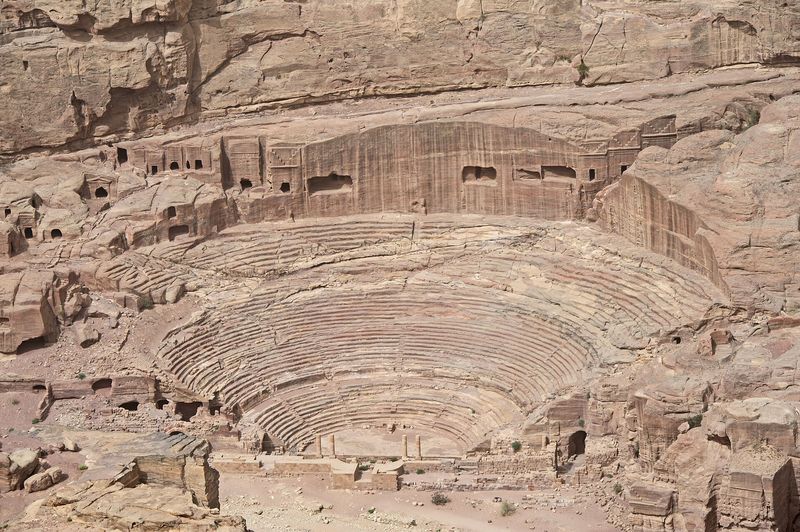
    The theatre. Photo & credit · Dosseman · CC BY-SA 4.0

    What we are looking at

    UNESCO counts Al-Khazneh, the Urn Tomb, the Palace Tomb and the Corinthian Tomb among the “Royal Tombs”: all of them combine Hellenistic and Eastern features. F The Urn Tomb later, in the Byzantine era, became a church. F

    What to notice

    • the lower arched supporting galleries and the broad terrace in front of the Urn Tomb;
    • the traders’ stalls on the terrace: the place is alive today;
    • the rows of the theatre, cut into the rock nearby.

    Historical depth

    The theatre was probably built under Aretas IV (9 BCE – 40 CE) V — a Nabataean king whose daughter married Herod Antipas. F In this way the city life of Petra is tied to the wider politics of the Near East.

    A curious fact

    None of Petra’s famous tombs can be dated precisely — there are too few finds. F That is why guidebook captions say “about” and “probably”: it is more honest than exact years.

    Video view

    There is no video for this stop. Our checked list has no reliable clip in which the facades of the Royal Tombs are clearly visible. We do not insert a random video just to fill the space: one clip was rejected as a slideshow with a watermark and unrelated inserts.

    Stop 4 of 6 · ≈ 0.6 km from the Urn Tomb

    The Colonnaded Street and the Great Temple

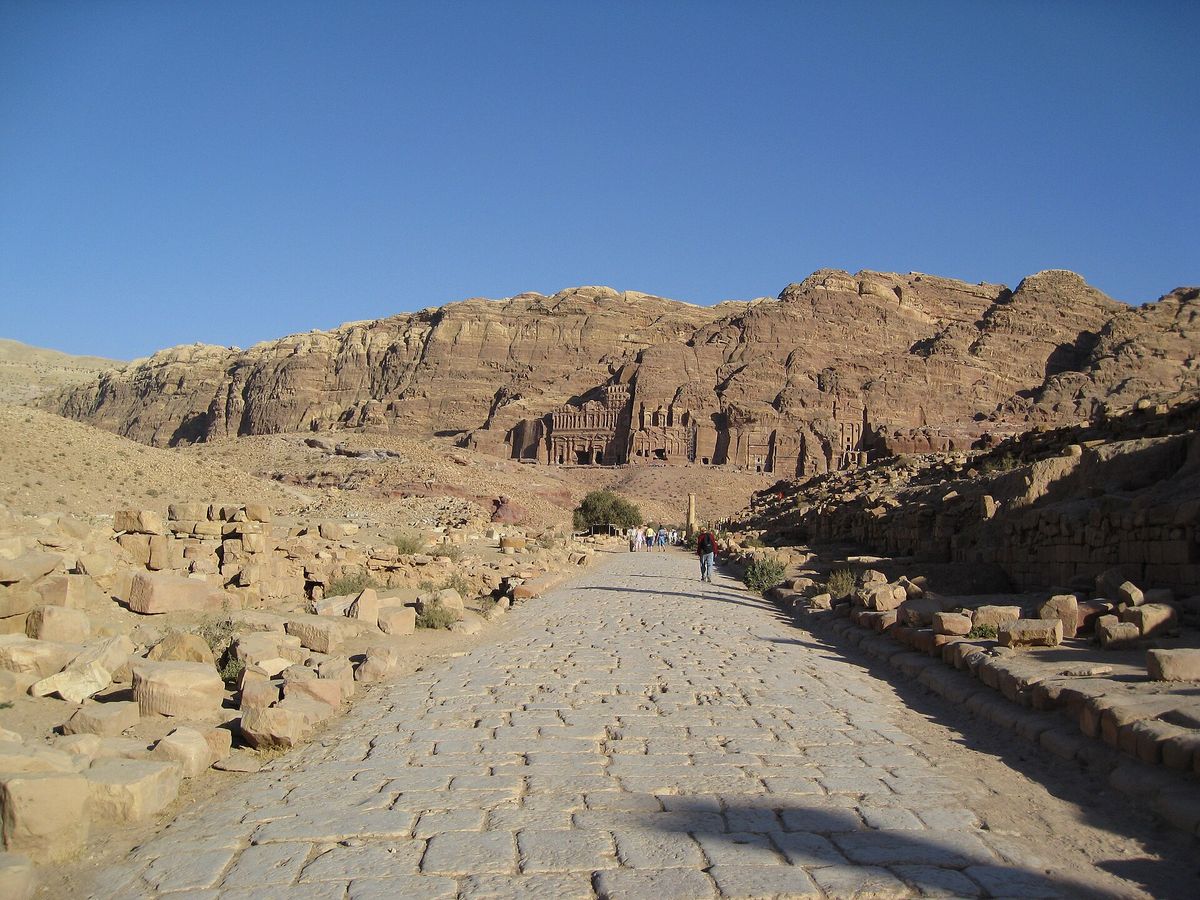
    Here Petra stops being a “city of facades” and becomes a city.

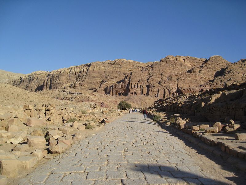
    The paved Colonnaded Street of Petra, with the Royal Tombs on the slope in the distance
    The Colonnaded Street; the Royal Tombs are on the slope in the distance. Photo & credit · ChrisYunker · CC BY 2.0
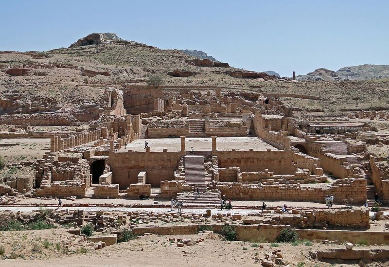
    The ruins of the Great Temple: steps, terraces and remains of columns
    The Great Temple. Photo & credit · Bernard Gagnon · CC BY-SA 3.0

    What we are looking at

    UNESCO lists the remains of a Greco-Roman layout: the colonnaded street, the triple-arched gate, the theatre, the nymphaeum (a public fountain) and baths. F

    What to notice

    • the paved road along which city life moved;
    • the steps, terraces and fallen column drums of the Great Temple;
    • capitals with elephants and winged lions — they occur in Petra; nearby is the Temple of the Winged Lions. F

    Historical depth

    Excavations changed the picture of the city: the “Lower Market” turned out to be a garden-and-pool complex. F Stone seats were found in the Great Temple — it may also have served as an assembly hall. V

    A curious fact

    A garden with a pool in the middle of the desert is one of the clearest signs of how well the Nabataeans managed water.

    Video view

    Walk around the area An amateur clip by Travel and Traverse by Binu VV (“PETRA 4”) with some camera shake. The frames we checked show an information map (60 s) and steps with column drums in the temple area (500 s); we did not verify architectural details from the clips. YouTube

    Stop 5 of 6 · ≈ 0.23 km from the Great Temple

    Qasr al-Bint

    The city’s main sanctuary — a building made of stone blocks, not carved out of the rock.

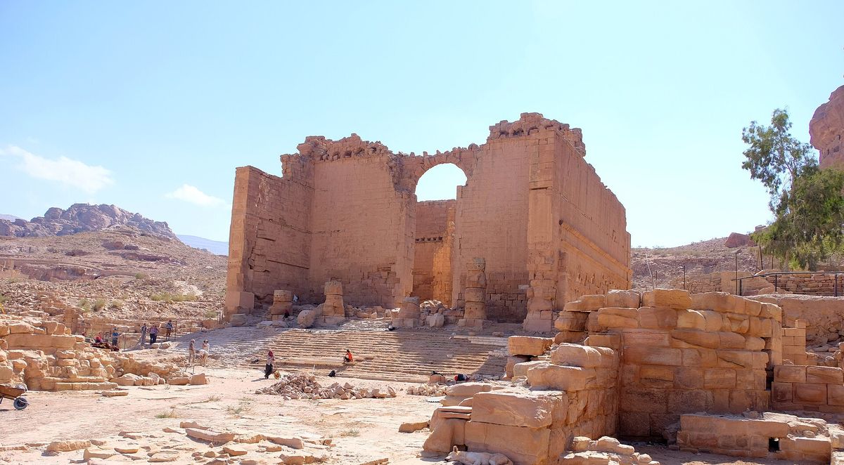
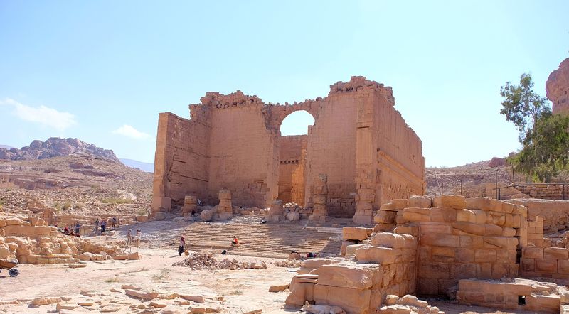
    The massive wall of Qasr al-Bint with a large arch; archaeologists at work on the ground in front of it
    Qasr al-Bint; archaeologists can be seen at work in front of it. Photo & credit · Davide Mauro · CC BY-SA 4.0

    What we are looking at

    The main sanctuary of Petra. It was probably built under Aretas IV, and which deity it was dedicated to is unknown. V The building stands at the western end of the Colonnaded Street — where the commercial part of the city passes into the sacred one.

    What to notice

    • the massive wall with a large arch;
    • the gate of the sacred precinct (temenos) nearby;
    • the working archaeologists in the photo: excavations are still going on.

    Historical depth

    This building shows the side of Nabataean architecture that the famous facades do not convey: it was built, not carved. From here the climb to the Monastery begins.

    A curious fact

    The name Qasr al-Bint (“the girl’s palace”) is a popular one; the building’s historical name has not been established. We do not use the explanation through “the pharaoh’s daughter”: it rests only on a tourist source.

    There is no separate video: Qasr al-Bint appears in the same clip as stop 4 — see above (a walk around the area, partly checked).

    Stop 6 of 6 · ≈ 1.3 km from Qasr al-Bint

    Ad Deir, “the Monastery”

    The finale of the route — a huge facade on an open plateau high above the city.

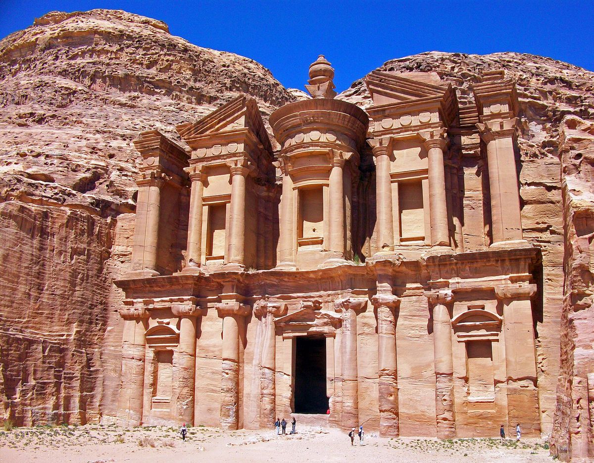
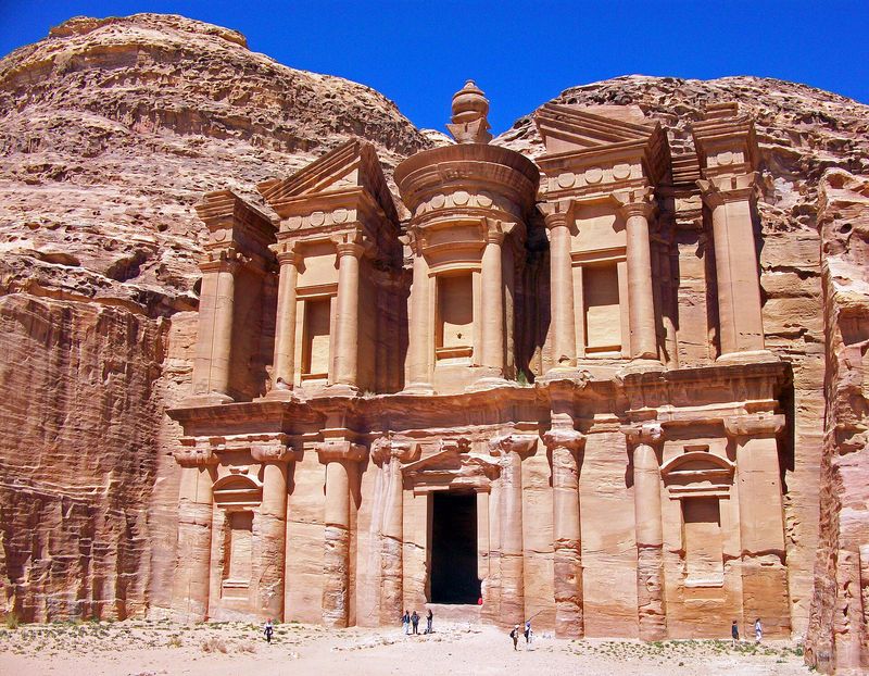
    The huge facade of Ad Deir (the Monastery) with people at its foot for scale
    People at the foot show the scale of the facade. Photo & credit · Daniel Case · CC BY-SA 3.0
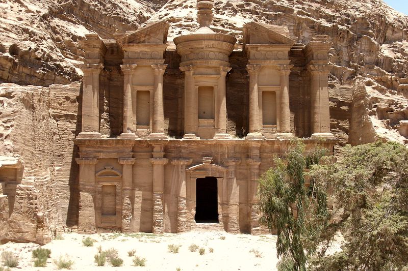
    The whole facade of the Monastery on its open plateau
    The whole facade. Photo & credit · Vyacheslav Argenberg · CC BY 4.0

    What we are looking at

    UNESCO includes Ad Deir among the monuments that blend Hellenistic architecture with Eastern traditions. F The name “Monastery” is conventional: historically it was not a monastery, which is why it appears here in quotation marks. V

    What to notice

    • the scale: compare the facade with the people at its foot;
    • the level ground in front of the facade;
    • the stairway used to climb up here, and the viewpoints around.

    Historical depth

    According to National Geographic, the Monastery may be the only elevated platform in Petra larger than the recently found monumental platform. F

    According to travellers

    The climb is about 800–850 steps, roughly 45 minutes up; the viewpoints nearby need about another 100 steps. These are individual authors’ estimates (see the section), not measured data.

    Video view

    Walk along the route This is the climb along the trail, not a look at the facade. The frames we checked show the trail (300 s), shops near the top (1000 s) and a stone stairway (2400 s); the facade of the Monastery was not spotted in the frames we viewed. YouTube

    Bonus off the route

    The High Place of Sacrifice

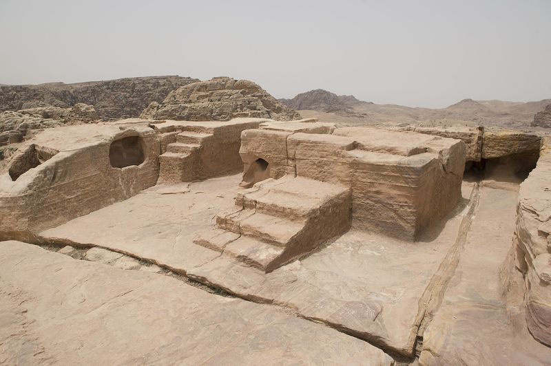
    Among Petra’s religious “high places”, UNESCO names several mountains, including Jabal al-Madbah. F Such places stand on mountain heights above the city. For this spot we have neither a verified video nor verified coordinates — only a photo; we do not invent a detailed description.

    Continue: discoveries and facts →

    The High Place of Sacrifice in Petra: a rock platform among the mountains
    Photo & credit · Dosseman · CC BY-SA 4.0
    Time

    The history of Petra

    Only confirmed events. A dashed line marks what scholars consider probable but not proven.

    1. The settlement of Beidha next to Petra.

      UNESCO
    2. The copper mines of Umm al-Amad.

      UNESCO
    3. A settlement at Umm al-Biyara.

      UNESCO
    4. The period of Nabataean civilisation, according to UNESCO’s estimate.

      UNESCO
    5. The probable founding of Petra as the Nabataean capital. The date is disputed — the page shows a range, not an exact year.

      National Geographic · hypothesis
    6. The time when the tomb facades were built; a shortage of finds prevents more precise dating.

      Lumen/SUNY · specialists’ estimate
    7. The reign of Aretas IV; the probable time of the theatre and Qasr al-Bint.

      Lumen/SUNY · hypothesis
    8. The Roman annexation. Most of the great tombs and buildings were built before it.

      NPR, Lumen/SUNY
    9. The Colonnaded Street, the nymphaeum, the triple-arched gate, baths.

      UNESCO
    10. A basilica with three apses; a church in the Urn Tomb.

      UNESCO
    11. By the end of the Byzantine period the city is almost abandoned.

      National Geographic
    12. The name “Wadi Musa” first appears in Crusader documents; later, a fortress in the “Valley of Moses”.

      Aramco World
    13. Johann Ludwig Burckhardt, travelling incognito, reaches Petra. The city itself was “never lost”.

      Aramco World
    14. Petra is inscribed on the UNESCO World Heritage List.

      UNESCO
    15. Satellites and drones reveal a monumental platform ≈ 56 × 49 m about 0.8 km south of the centre; Petra has no parallels for it. Its purpose is a hypothesis.

      National Geographic
    16. Ground-penetrating radar helps find a hidden tomb with 12 skeletons beneath the Treasury; preliminary dating: 1st century BCE – 1st century CE.

      NPR
    Mysteries and discoveries

    Curious facts and discoveries

    For each discovery: what is known and what remains a question. These are different things, and we do not mix them.

    The secret tomb beneath the Treasury (2024)

    Ground-penetrating radar showed a void beneath Al-Khazneh, and excavation uncovered a hidden tomb about 5.5 × 5.5 m and about 2.7 m high, with 12 complete skeletons.

    KnownThe tomb was found and the skeletons are preserved; preliminary dating: 1st century BCE – 1st century CE.
    UnclearWho these people were. It is a rarity for Petra: in most tombs almost no remains have been found.

    A platform seen from space (2016)

    Satellite images and drones revealed a monumental platform of about 56 × 49 m in the centre of Petra, ≈ 0.8 km south of the centre.

    KnownThe platform exists; Petra has no parallels for it.
    UnclearWhat it was used for — this is a hypothesis.

    The “market” that was a garden

    The Lower “Market” turned out in excavation to be a garden-and-pool complex. And in the “Great Temple” stone seats were found.

    KnownA garden with a pool; seats were found.
    UnclearWhether the Great Temple was primarily an assembly hall — a scholarly view.

    Al-Khazneh to scale

    The facade of the Treasury is 24.9 m wide and 38.8 m high. That is almost 39 m — about the height of a modern 12-storey building (our own calculation). F Dimensions are from Lumen/SUNY.

    Beside it on the diagram is a person 1.7 m tall (illustrative): barely visible at the foot.

    38.8 m 24.9 m 1.7 m

    Twelve more confirmed details

    1. Petra is “half built, half carved into the rock” (UNESCO).
    2. The composition of the Treasury comes from Alexandria; the facade shows Isis-Tyche and the Dioscuri (Lumen/SUNY).
    3. The name “the Pharaoh’s treasury” grew out of a legend; Bedouin shot at the urn hoping for gold (Aramco World).
    4. No famous tomb can be dated precisely — there are almost no finds (Lumen/SUNY).
    5. In 2024 a hidden tomb with 12 skeletons was found beneath the Treasury (NPR).
    6. The Lower “Market” turned out to be a garden with a pool (Lumen/SUNY).
    7. Stone seats were found in the Great Temple — as in an assembly hall, according to researchers (Lumen/SUNY).
    8. Capitals in Petra include elephants and winged lions (Lumen/SUNY).
    9. About a million cubic metres of water run into the Siq each winter (Cultech estimate); that is why the Nabataeans diverted the flow through a tunnel.
    10. The monumental platform in the centre of Petra was noticed only in 2016, from space images (National Geographic).
    11. The daughter of King Aretas IV married Herod Antipas (Lumen/SUNY).
    12. Petra was never “lost”: in 1812 Burckhardt merely made it known to Europeans (Aramco World).
    Through travellers’ eyes

    What those who have been there say

    We have summarised recurring observations from travellers’ accounts published on blogs between 2012 and 2025. Each observation is a paraphrase in our own words, with links to the originals and a note on how it helps a future visitor. If an opinion appears with only one author, we say so plainly.

    What impresses most

    In the morning there are almost no crowds at the Treasury

    Four authors advise arriving early: then you can look at Petra’s signature view without a queue of people.

    Why it helps: your entry time decides whether you see Al-Khazneh in peace.

    Quiet away from the main trail

    Two authors write that on the climb and at the “back” views of the city there are almost no people, and the trails around offer a break from the stream of visitors.

    Why it helps: if you dislike crowds, look for side routes.

    Unexpected discoveries

    The view down onto the Monastery is worth the extra steps

    One author writes that the viewpoints around the Monastery are worth roughly a hundred extra steps. This is a single opinion and should not be generalised.

    Why it helps: it shows that at the end of the climb there is a choice whether to go on.

    Difficulties

    The climb to the Monastery

    The author of Atlas & Boots gives about 800–850 steps and up to 45 minutes going up; the author of thetravelblog.at writes of “endless steps”. These are personal estimates, not measured data.

    Why it helps: it helps you plan your energy and the time of day.

    Animals and vendors

    Donkey and horse rides are an option for those who find walking hard, but there are reports of mistreatment. The author of yogawinetravel.com advises thinking it over, and describes vendors and drivers as a minor source of pressure.

    Why it helps: it shows what to decide in advance, not on the trail.

    The cost of the trip

    One author calls Petra one of the most expensive day trips. This is a single opinion from 2016; we have not checked current prices.

    Why it helps: it is a reminder to check prices with official sources (see “Practical information”).

    Tips

    Arrive at opening time, or go to the Monastery before lunch

    After midday it is hot and there are more donkeys on the trail. Atlas & Boots suggests starting with the Monastery and seeing the rest on the way back.

    Why it helps: it helps you order your route.

    Consider a two-day ticket

    According to the author of thirdeyemom.com, walking the whole park takes a day (6–8 hours); Atlas & Boots calls a two-day ticket worthwhile.

    Why it helps: it helps you estimate how many days to set aside.

    Expectations and reality

    ExpectationPetra is the Treasury and a few photos near the entrance.
    Reality, according to the accountsIt is a whole city: according to the author of thirdeyemom.com, covering the park takes up to a full day; Atlas & Boots calls a two-day ticket worthwhile. Sources: thirdeyemom.com (2020), atlasandboots.com (2016)

    Conflicting opinions

    Best time of dayMorning — so say drinkteatravel.com, thirdeyemom.com and thetravelblog.at. But picturetheworld.co (2025) notes that there may be fewer tourists in the daytime. This is a single opinion.
    Donkeys and horsesA help for those who cannot walk (yogawinetravel.com, 2019) — and an ethical problem (atlasandboots.com, 2016).

    Two more accounts were read — viajeroscallejeros.com (3 Oct 2025) and mochileandoporelmundo.com (26 Mar 2023), in Spanish: they mention Little Petra but give no assessments, so they are not used in the conclusions. All the authors write in English or Spanish; prices and rules may have changed over these years. This is a paraphrase without quotations, not a ranking and not a study.

    If you go

    Practical information

    We do not give prices, opening hours or safety rules: they could not be confirmed with official sources, and such data go out of date quickly.

    What is known from accounts

    • The climb to the Monastery is a steep stairway, about 800–850 steps (Atlas & Boots).
    • Seeing the whole park can take a full day (thirdeyemom.com).
    • It is better to start early — so write four authors.
    • The park opened at about 6:00 (thetravelblog.at, 2017) — check the current time.

    Distances

    • From the entrance to the Siq (Bab al-Siq) to Al-Khazneh it is ≈ 1.1 km in a straight line; the real path through the gorge is longer — about 1.1–1.5 km.
    • The sum of the straight segments between the six stops is ≈ 3.3 km (calculated from approximate coordinates); the straight line from the Siq (stop 1) to the Monastery is ≈ 2.9 km. This is not the length of the trail: the real path is longer and includes a climb.

    Where to check current information

    Check that it is current. Tickets, opening hours, safety, weather and restrictions can change. Before you travel, rely on official sources, not on blogs or this page.
    Explore for yourself

    Compare two sites

    Choose two places in Petra and see how they are alike and how they differ. Confirmed data, estimates and scholarly views are marked differently.

    A 6-question quiz (optional)
    Where next

    Keep exploring

    Places linked to Petra by history or geography (from the UNESCO description and verified sources). The links lead to Wikipedia pages — reference material, not our own pages.

    Near Petra

    Little Petra

    A caravan stop with tombs, temples and cisterns near Petra (UNESCO). Travellers recommend it as a quiet start to the route.

    Read about Little Petra →
    Before the Nabataeans

    Beidha

    A Neolithic settlement near Petra: it shows that people lived here long before the Nabataeans.

    Read about Beidha →
    Metal

    Umm al-Amad

    Ancient copper mines (copper workings of the 4th millennium BCE according to UNESCO): the resource side of the region’s history.

    Read about Umm al-Amad →
    Holy place

    Jabal Harun

    By tradition the burial place of Aaron; a mosque stands at the mountain (UNESCO). It shows the religious life of the valley.

    Read about Jabal Harun →
    The Crusader era

    Montreal (Shobak)

    A Crusader fortress tied to the later history of the region (UNESCO’s Petra listing mentions the fortresses of Habis and Wu’ayra).

    Read about Montreal →
    Another Nabataean capital

    Mada’in Salih (Hegra)

    Another Nabataean centre with rock-cut tombs, in Saudi Arabia: you can compare it with Petra. Lumen/SUNY mentions 31 dated tombs.

    Read about Mada’in Salih →

    The next AtlasUnfold virtual expeditions are still in development: their pages will appear here when they are ready.

    Transparency

    Sources and method

    The historical information is based on open scholarly and documentary sources. Photographs come with details of their authors and licences. Travellers’ impressions are summarised from published accounts, with the originals credited.

    Photographs: authors and licences

    All photographs are from Wikimedia Commons. For each one we give the title, author, a link to the original file, the exact licence and details of changes. Next to photographs on the page there is a “Photo & credit” button that opens a card with the same details. The metadata was checked against Wikimedia Commons on 17 November 2026; the content of each file was matched with the original on Commons.

    No additional copyright notices or restrictions are stated on the Commons file page (checked 17 November 2026). The image is provided “as is”, without warranties — see the licence text.

    What each licence requires

    CC BY 4.0
    You must credit the author, link to the licence and indicate any changes made. The attribution details may be provided through a link to a page that holds them. Commercial use is allowed.
    CC BY-SA 4.0
    You must credit the author, link to the licence and indicate changes. Derivatives, including a resized copy, must be shared under the same licence (CC BY-SA 4.0); attribution details may be provided through a link to a page that holds them. Commercial use is allowed.
    CC BY 2.0
    You must credit the author and title of the work, link to the licence and to the source, and indicate that the work has been changed. Commercial use is allowed.
    CC BY-SA 3.0
    You must credit the author, link to the licence and indicate changes. Derivatives, including a resized copy, must be shared under the same licence (CC BY-SA 3.0). Commercial use is allowed.

    A short summary; the full licence text at the link is what is legally binding.

    Detailed register: method, video, coordinates, limitations

    Method

    The texts were written afresh from the sources we read, without copying. Statements are marked: F — confirmed by a source we read, V — a view or estimate of researchers. Information that could not be confirmed is not used on the page. We carried out no fieldwork and did not visit the sites in person; the photographs are not ours. The page is not presented as endorsed by any publisher or advertising network. The Russian and English versions are editorial adaptations of the same verified material; proper names follow common English usage.

    Video

    Stop 3 has no video. Frames were checked selectively (2–3 frames per clip). All players are official YouTube iframes, loaded on click.

    Scholarly and reference sources — notes

    • UNESCO, World Heritage Centre — the primary description of site no. 326.
    • NPR (J. Doubek, 2024) — a journalistic piece on the 2024 discovery.
    • National Geographic (K. Romey, 2016) — based on research by S. Parcak and Ch. Tuttle.
    • Aramco World (1991) — an overview article on the myths and reality of Petra.
    • Lumen/SUNY — art-history teaching materials.
    • Cultech — material from an organisation, not a peer-reviewed publication: used for flood estimates, marked “estimate”.
    • Coordinates: OpenStreetMap (Nominatim search) © OpenStreetMap contributors (ODbL) and Wikipedia; the values agree to within about 50 m.

    Limitations

    Publications by Brown University, the Smithsonian, the Jordan Times and scholarly PDFs on the water system were not read. There are no data on tickets, opening hours or safety. There are no photographs of Little Petra, the Siq’s water channels or the Temple of the Winged Lions. The videos were checked selectively.